Housing Scheme Layout Plan with Plot Division Road Network Design
Tags
Ratings & Reviews
Be the first to share your experience with this product. Your review helps others make better decisions!
Description
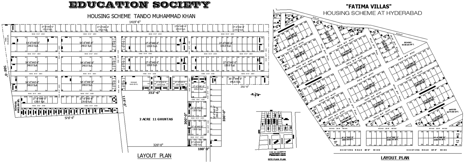
This layout drawing presents a detailed planning arrangement for a residential housing scheme with organized plot divisions and road networks. The drawing aligns with Architecture Urban Projects by illustrating systematic land distribution, internal road connectivity, and block-wise plot organization within a defined site boundary. Plot dimensions, road widths, and open space allocation are clearly represented to support urban-level planning and land-use understanding. The layout helps in visualizing how residential plots, community facilities, and circulation paths are structured across the housing scheme area.
The drawing also supports Public Space Projects by showing reserved areas for shared facilities such as schools, mosques, and open spaces integrated within the layout. These spaces are positioned to ensure accessibility and balanced distribution across the scheme. In addition, the layout relates to Town Design And Planning, where zoning clarity, road hierarchy, and plot orientation play a key role in organized development. The drawing further connects with Public Park Projects by indicating green or open zones planned within the residential layout. Overall, this layout drawing is useful for understanding housing scheme planning, urban land subdivision, road layout coordination, and community-focused development planning.

Uploaded by:
Eiz Luna
Tags
Ratings & Reviews
Be the first to share your experience with this product. Your review helps others make better decisions!